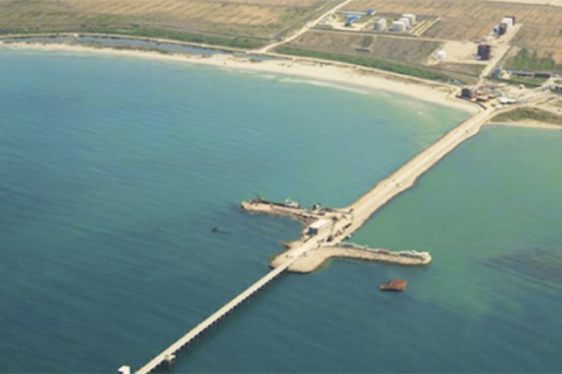
New Port in Porto Romano, Model Selected
Between the two alternatives for the development of the new commercial Port in Porto Romano, where the activity of the current Port of Durrës will be moved, the government has chosen the C2 model.
This model envisages a port developing onshore rather than variant C1 which envisages development at sea.
A study related to the project and the environmental impacts of its implementation drawn up by Royal HaskoningDHV, Abkons and a number of other companies underlines that the integrated Port of Durrës - Porto Romano will implement this model as the costs are lower than the development case in the open sea, local news provider Monitor reported.
But what these costs are, the study has no data since it deals simply with environmental effects. The total area of the new port is estimated at 300 hectares.
The current area where the Port of Durrës project is planned to be developed in Porto Romano consists mainly of agricultural lands benefited from the reclamation of the former marsh of Durres.
Surface water drainage is guaranteed by a system of open drainage channels, which converge at the point with the lowest quota in the area, where the pumping station is currently located.
In the western part of the coast, there are seasonal activities related to tourism such as private beaches, bars and restaurants.
In the northern part, the deposits of the hydrocarbon company Royal Trade sh.a are installed, while in the south the area is limited by the two concession areas of private ports, Romano Port sh.a and MBM sh.a.
On the borders of the development area, on the eastern side, is the Rinia village. At a distance of about 2-3 km to the south is the area planned for the realization of the Spitalla photovoltaic park.
Near the new port, in the northeast and southwest of the village of Rinia, residential constructions are planned. The Olympic Park/Ecological Park is also located near the port, the document states.
The summary of the non-technical report highlights that a C2 layout model was chosen for several reasons. First of all, an inland port is the least expensive development option.
The cost of building breakwaters in deep sea water is considerable. Also, the cost of offshore reclamation to form land for port development is also considerable.
Although the volume of dredging required to provide navigable access will be greater for inland port development, some of this dredging will be sand, which can be usefully used to fill inland areas of low for port development.
It is currently envisaged that the material excavated from the inland basins will be fine silty sand, which can be used to form the new harbor platform by hydraulically filling the low lying areas. This will reduce the cost of fill reclamation and the need to dispose of excavated material in outfall areas.


